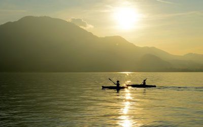
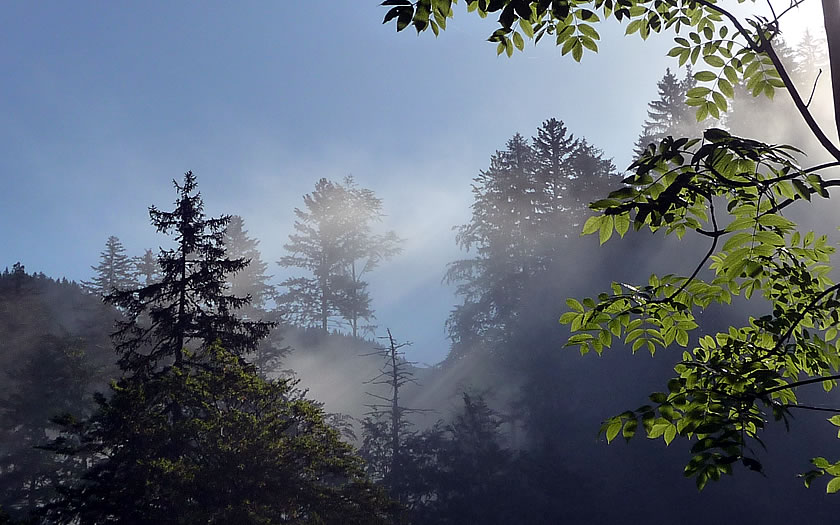
The Kalkalpen National Park is a protected area renowned for its streams and woods in the southern-eastern part of Upper Austria.
The mountainous area essentially consists of the Sengsengebirge range and the Reichraminger Hintergebirge – a total of around 210km2.
However much of the interest in the area is not in bagging the mountain peaks but in exploring the routes through the park or the less accessible areas, especially those to the north of the park area.
The Kalkalpen region – more than many national parks – also has extensive areas surrounding it which are also under a lesser degree of natural protection but which add to the attractions of outdoor pursuits in the area. Thus the Enns valley, the Steyr valley and the Pyhrn-Priel area to the south can all be considered part of the Kalkalpen area without necessarily being part of the official National Park.
Many visitors might sample the hiking and biking trails on the southern edge of the park around Windischgarsten and Spital am Pyhrn or visit the source of the Steyr in the Stoder valley to the southwest to supplement what is on offer in the National Park itself.
History of the Kalkalpen National Park
The Kalkalpen had been used for many centuries for various economic purposes, such as mining and logging and, at the beginning of the 20th century, the Steyrdurchbruch power station near Molln was constructed to make use of the abundant water in the area. A forestry railway into the Hintergebirge from Reichraming was built in the 1930s.
More plans for the use of the area for hydro-electric power were proposed in the 70s and early 80s and this led to the formation of a protest group to protect the natural landscape and to the first proposals for the national park. This was agreed by the Upper Austrian provincial government and the National Park was created in 1997, followed shortly afterwards by certification from international authorities.
The original park area has been increased twice since the beginning of the new century to its current size of around 210km2. Lynx and brown bears have been spotted in the park since the foundation of the reserve and it is now considered one of the most important protected areas of woodland in the Alps. Over 70% of the park is considered to be ‘forest wilderness’ where no forestry work is allowed.
Don’t Miss
Don’t miss:
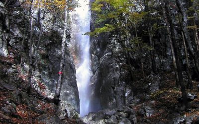
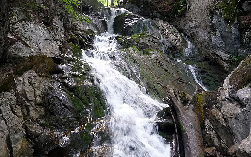
- the ‘Rinnende Mauer’ just outside Molln (a spring which cascades over an overhang of around 50m in length)
- Dr Vogelgesang Gorge, the second longest in Austria (ca. 1500m) located to the south of Spital am Pyhrn
- the Kalkalpenweg – suitable for keen long-distance walkers, this path from the Enns valley through the Kalkalpen National Park to the karst landscape of the Totes Gebirge above Hinterstoder covers 11 daily stages and 150km in total
How to Get to the Kalkalpen
Like its near neighbour, the Gesäuse National Park, access to the Kalkalpen is easiest via the A9 Pyrhn Autobahn, which connects Linz and Graz. Certainly it is the most accessible route for those arriving from everywhere but the east. In this case, probably the easiest option is a cross-country route via Steyr – in the case of those coming from Vienna, there is also an option of coming in from the south via Wiener Neustadt and Leoben.
The largest population centres and ‘tourist towns’ are located on the southern side of the park.
Nearest Airport
The closest airport is at Linz (80km) – it has decent connections to Vienna and some German cities. However, for a decent choice of flights, the options of Salzburg Airport (150km away with a good range of charter flights in season) and Vienna (270km – connections befitting the capital city) might come into play.
Nearest Train Stations
There is a good choice of rail access for the Kalkalpen region. Windischgarsten to the south is on the main line between Linz and Liezen, as are Klaus and Kirchdorf am Krems in the northwest (public transport access to Molln). The eastern side of the park can be accessed via the stations at Weissenbach and Reichraming, which are on a different regional rail link to Linz.
Best Accommodation Bases for the Kalkalpen
The main ground for choosing one or another of the first two options listed below would be whether you want to be on the northern or southern side of the National Park. Großraming is a little bit more isolated from the rest of the park areas.
Windischgarsten
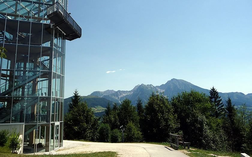
Windischgarsten is the largest tourist centre on the southern side of the park. The small town has good transport links and houses one of the national park centres on the Wurbauerkogel mountain just outside the town. There is good access to the Kalkalpenweg as it exits the southern side of the national park and to the lower walks on the alms around the Hengstpass area. Spital am Pyhrn and the mountains and alms of the Haller Mauern are situated a few kilometres to the south.
Molln
Molln is a slightly larger but less tourist-oriented town on the River Steyr to the north of the park which houses the park headquarters. Public transport connections are by bus only and the town is a fair distance from the northern border of the park, so the destination would probably suit those with their own transport better. However it does have more of interest in the immediate vicinity like the ‘Rinnende Mauer’ feature and the River Steyr.
Grossraming
This is the main settlement to the northeast of the park and provides the easiest access to the woods and gorges of the Reichraminger Hintergebirge section of the park. The area has a mix of activities, from easier alm walks through to the more serious hikes into the gorges formerly used by the timber workers, a bike ride along the former route of the forestry railway and timber raft trips along the Enns.
Kalkalpen Accommodation Map
Check accommodation availability in the Gesäuse National Park area with this map from Booking.com. Use the ‘+’ and ‘-‘ signs to zoom in on an area and reveal more options.
Kalkalpen Video
Useful Sites
- Official park site: www.kalkalpen.at
- Official tourist office site for the Enns and Steyr valleys: www.nationalparkregion.com
- Official tourist office site for the Pyhrn-Priel region: www.urlaubsregion-pyhrn-priel.at
- Austrian railways: www.oebb.at
- Vienna airport: www.viennaairport.com
- Linz airport: www.linz-airport.com
- Salzburg airport: www.salzburg-airport.com
- Graz airport: www.flughafen-graz.at