Last updated on April 8th, 2020 at 06:49 am
Discover the hidden beauty of the Karawanken Mountains
Southern Carinthia- more precisely the regions Villach – Faaker See – Ossiacher See, the Carnica region Rosental and the neighbours over the border in Slovenia – have something that many envy. High mountains, lots of sunshine and a mild climate ideal for outdoor activities.
The Panoramaweg Südalpen (‘Southern Alps Panorama Trail’) crosses the Karawanken and the Saualpe and has been extended by four stages this year.
You don’t have to be a professional mountain walker to try it – although some of the 20 stages are a little more demanding – and, thanks to the relatively quiet panoramic paths and the famous three-country cuisine, you can take your time and enjoy the pleasures of hiking this trail.
The name of the trail tells you plenty.
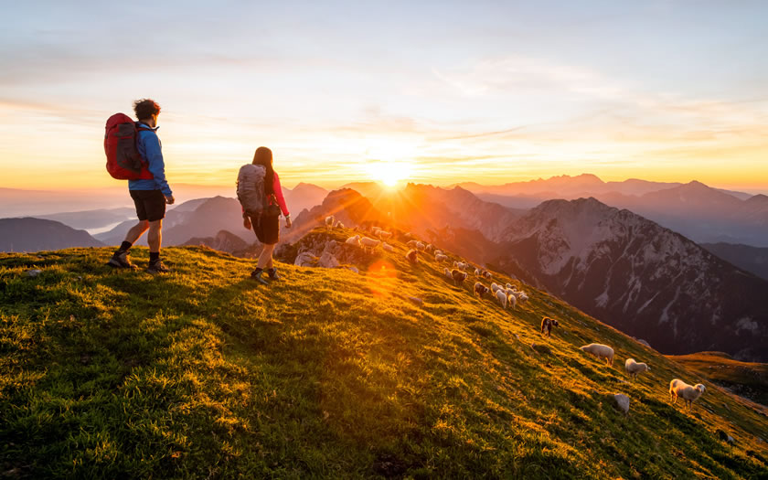
Wonderful views on the south side of the Alps, plus mighty mountains and plenty of sunshine. Across the Karawanken Mountains, along the Carinthian-Slovenian border, up to the Styrian border.
“Two mountain ranges rich in contrasts: one wild and bold, the other gentle and charming. The Panoramaweg Südalpen (Southern Alps Panorama Trail) combines these to create an impressive long-distance and high-altitude experience. Definitely a secret tip among Austria’s long-distance hiking trails,” enthuses Andreas Kranzmayr of Alpines Wandermanagement GmbH. He has walked the entire route as part of the certification process for the Austrian Hiking Quality Seal and knows all the special features.
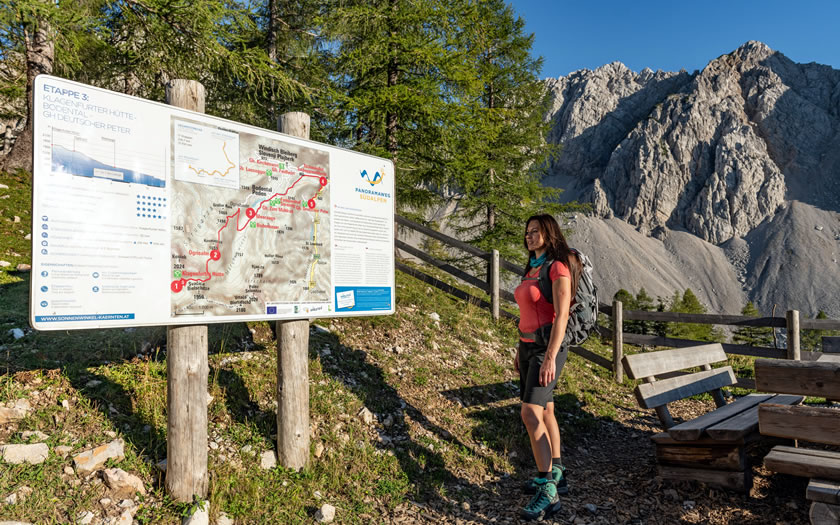
The trail offers 20 stages and 284 km, half of which run through the Karawanken Mountains. As a connection to the Karnische Höhenweg, it was extended this year from west to east by four stages from Thörl-Maglern through the southern part of the Villach – Faaker See – Ossiacher See region.
© Franz Gerdl | Carnica-Region Rosental
The route continues east into the renowned Rosental, through the Klopeiner See-Südkärnten region and up into the Lavanttal valley. The trail spoils hikers with lonely paths across idyllic alpine meadows, meanders through shady mountain forests and provides more than enough variety with enchanting villages, quaint inns and majestic vantage points.
Its individual stages lead across the border through four regions and two countries, are between ten and 21 kilometres long and offer a total of around 16,000 metres of uphill terrain. Anyone who finds one or the other stage too demanding can skip it and get back in later.
Across the Karawanken Mountains in 10 stages
After the start in Thörl-Maglern, the Panoramaweg Südalpen crosses flat meadows and winds eastwards through the mountain forest to the Wurzenpass.
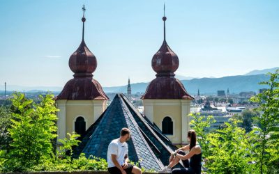
The second day’s destination is the Baumgartnerhöhe with the Baumgartnerhof above the ruins of Finkenstein Castle, whose arena is the venue for top-class cultural events in summer. There is an outdoor alternative to hiking up here on the Kanzianiberg, a well-known climbing area.
© Uwe Geissler | Kärnten Werbung
The first alpine stage leads further to Mittagskogel, at the feet of which the turquoise blue Faaker See glistens in the sunlight, and to Bertahütte, a classic and cosy refuge.
The hike from the Bertahütte to the Rosenkogel is a beautiful day trip with a view of the mighty Julian Alps. It heads over mountain meadows and through beech forests to the Slovenian Kahlkogelhütte.
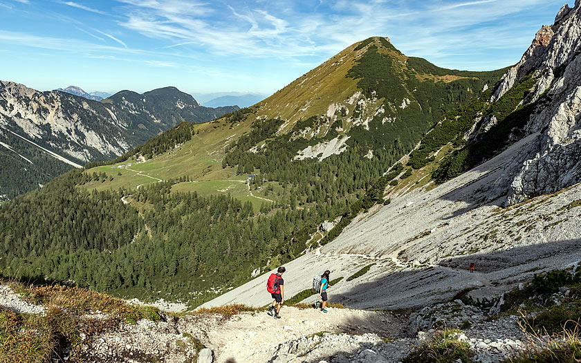
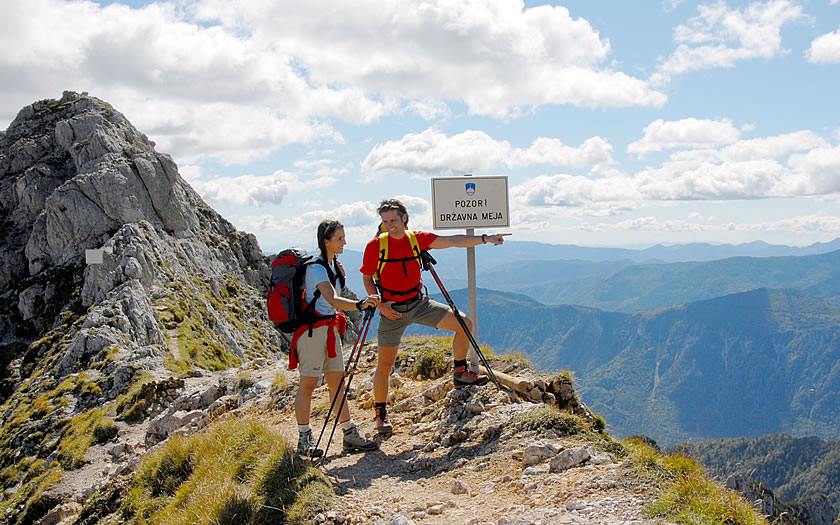
Then a long but scenic stage leads to the Hochstuhl, the highest peak of the Karawanken Mountains at 2,239 metres, and down to the day’s destination, the Klagenfurt Hut.
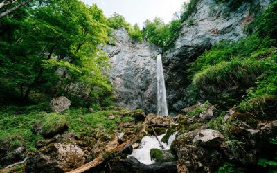
The next day, the trail leads through the forests of the Bodental valley, past beautiful places with magical names such as the Märchenwiese (‘fairytale meadow’). Meerauge (‘the sea-eye’) and the Tscheppaschlucht gorge, where the elemental force of water can be felt close at hand.
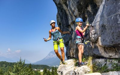
These stages in the heart of the Karawanken are now more alpine and demanding in nature – sure-footedness and a head for heights are definitely required.
© Franz Gerdl | Carnica-Region Rosental
This also applies to the long journey from the Gasthof Deutscher Peter via the Eselsattel and the Pischenzasattel to the Koschutahaus.
The next stage then runs spectacularly past the steep northern walls of the Koschuta up to the Potoksattel and further north descending to the Gasthaus Terklbauer. The Koschuta massif and above all the Koschutnikturm have become an attraction for numerous mountaineers.
In the second half of the 19th century this was still a very remote mountain area, mainly visited by hunters, prospectors and charcoal burners (and probably also smugglers). The upswing arrived with the development by the alpine associations and the construction of shelters.
The last stage of this Karawanken crossing leads over the Schaidasattel to the best panoramic mountain in Lower Carinthia, the 2,139-metre-high Hochobir, before the Karawanken crossing ends at the Eisenkappler Hütte and the Panoramaweg continues southeast.
Hike on trails in Carinthia and get a taste of Slovenia
The special attraction of this Karawanken tour is the variety of the landscape.
“What makes the Panoramaweg Südalpen so special for me is its diversity and originality. The trail begins at the intersection of three cultures and is characterised by a varied natural and cultural landscape,” says David Melcher from the Klagenfurt Environmental Office and a consultant for trails and huts at the Alpine Club.
He explored the new stages of the Southern Alps Panorama Trail last summer and he also has a few tips at hand: idyllic valleys and old mountain farms line the trail, as do alpine attractions.
© Region Villach Tourismus | Adrian Hipp
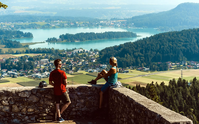
For example the majestic Mittagskogel, the wild Tscheppaschlucht gorge or the picturesque ‘fairytale meadow’ in the Bodental valley, which has the reputation of being Carinthia’s most beautiful mountain meadow. On the way you can take a detour to the warm bathing lakes.
The hike on both sides of the border from Carinthia to Slovenia also makes you familiar with different customs and traditions and above all with the advantages of three-country cuisine.
Thanks to the influences of its neighbours in Austria and Italy, Slovenian cuisine provides plenty of tasty encounters. They are sometimes difficult to pronounce, but the popular Štruklji have a lot to do with Topfenstrudel, a Palačinke corresponds to a pancake, and Njoki are similar to Italian gnocchi. Hikers will pick this up quickly along the trail.
Seldom is a language course so tempting and nutritious.
More information: www.visitvillach.at and www.carnica-rosental.at